Your Everyday Commercial Drone
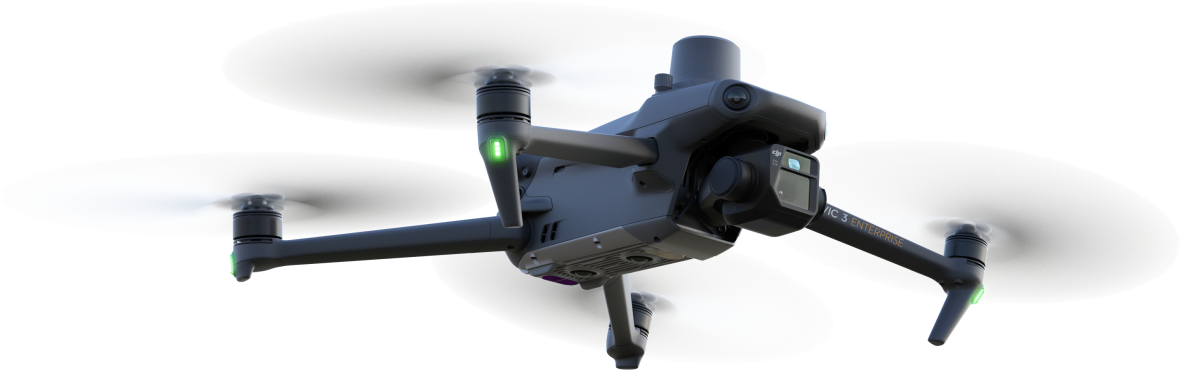
MAVIC 3 ENTERPRISE
Your Everyday Commercial Drone
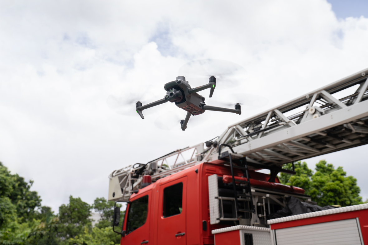
The Mavic 3 Enterprise Series redefines industry standards for small commercial drones. With a mechanical shutter, a 56× zoom camera, and an RTK module for centimeter-level precision, the Mavic 3E brings mapping and mission efficiency to new heights. A thermal version is available for firefighting, search and rescue, inspection, and night operations.

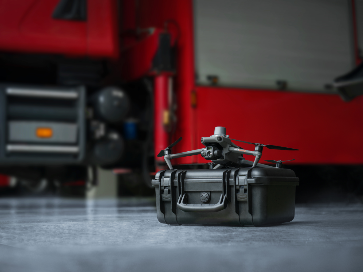
Compact and Portable

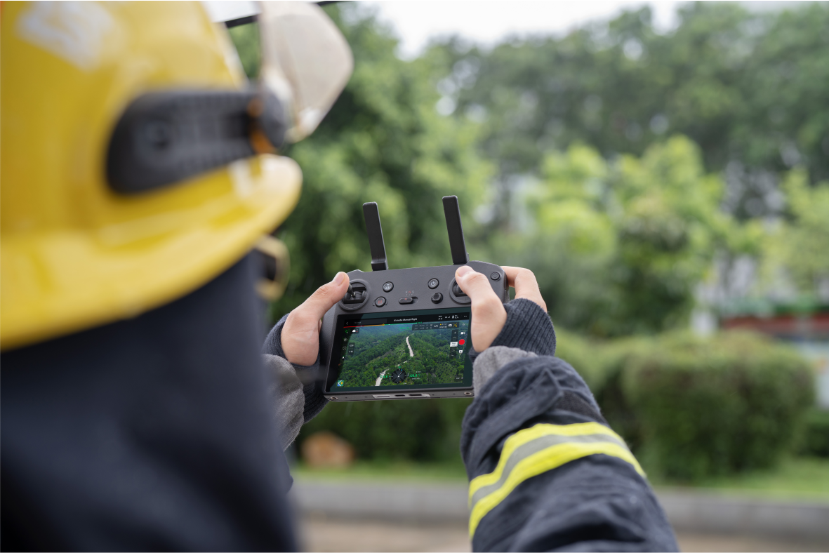
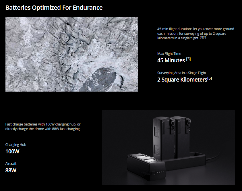
Streamlined and compact, Mavic 3 Enterprise Series can be carried in one hand and deployed at a moment's notice. Perfect for beginner and veteran pilots alike, it's built to perform on lengthy missions.
MAVIC 3 E
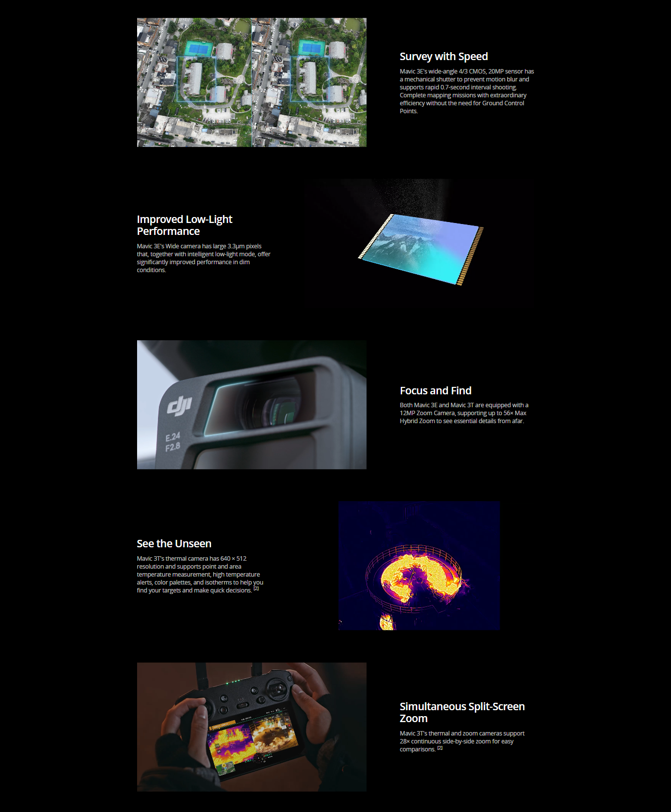
Wide
4/3 CMOS, 20MP, Mechanical Shutter
Tele
Equivalent Focal Length: 162mm, 12MP, 56× Hybrid Zoom
Premium Camera Performance
Exceptional Operational Efficiency
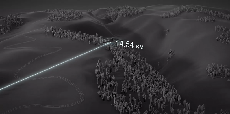
Next-Generation Image Transmission
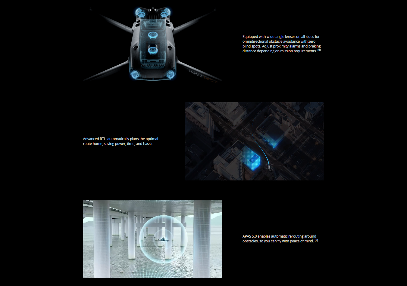
Quad-antenna O3 Enterprise Transmission enables more stable connections in a wide variety of complex environments.
Omnidirectional Sensing for Safe Flying
Flight Route
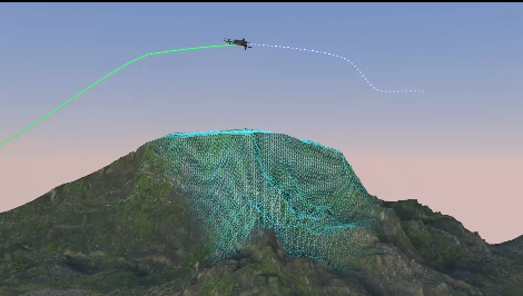
Real-Time Terrain FolloW Automatically adjust altitude when mapping areas with variations in elevation, all without needing to import external elevation data thanks to Mavic 3E's omnidirectional sensing.
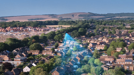
| Smart Oblique Capture Elevate the efficiency of your oblique photography mission with Smart Oblique Capture. During flight, the gimbal automatically rotates in three directions: front, middle, and back. Two routes can collect all photos at the angles needed for high-precision 3D modeling.
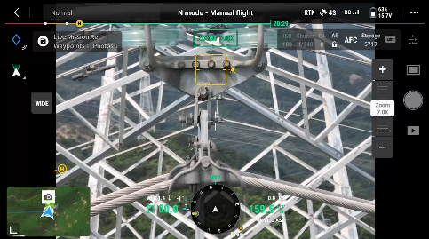
| Live Mission Recording Record mission actions such as aircraft movement, gimbal orientation, photo shooting, and zoom level to create sample mission files for future automated flights.
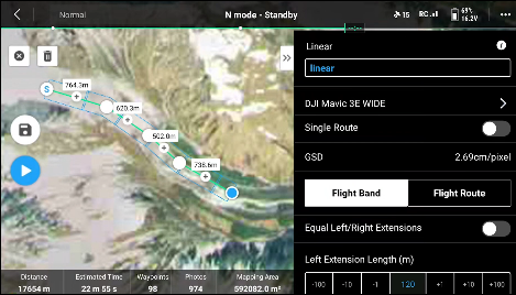
| Linear Mission Planning Create automated flight missions of highways, rivers, oil pipelines, and more with Linear Mission Planning. Simply draw a line on the map and it divides the area into mappable segments for straightforward surveying.
|
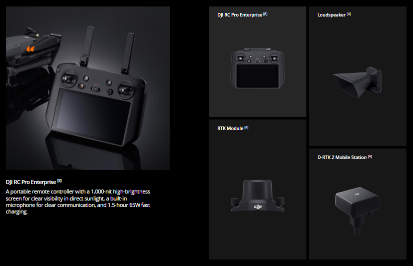
Abundant Accessories
Full Software Suite
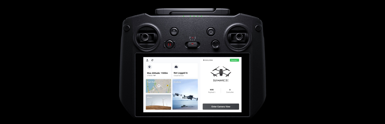
DJI Pilot 2
A revamped Enterprise flight interface designed to improve piloting efficiency and flight safety. Drone and payload controls can be easily accessed with one tap. Clear presentation of flight details and navigational information improves user experience together with support for various route types.
DJI FlightHub 2
All-in-one cloud drone operations management for your fleet with support for live annotations and cloud mapping for seamless ground-to-cloud synergy. Efficiently manage inspection operations with route planning and mission management.

DJI Terra
Full featured mapping software for all stages of work, from mission planning to processing of 2D and 3D models.

DJI Thermal Analysis Tool 3.0
Analyze, annotate, and process images captured by M3T using DTAT 3.0 to detect temperature abnormalities in your inspections.

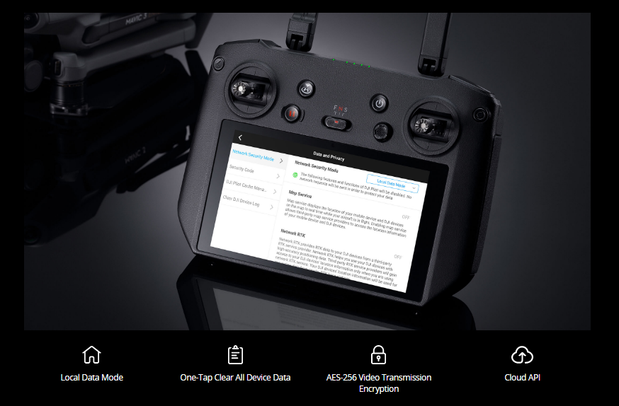
User Data Security